Making nature data accessible
Introducing Cecil's approach to solving nature data's accessibility problem.
Welcome to the nature data newsletter. Each month, we share insights with data enthusiasts, GIS experts, and investors learning about nature data.
We envision a world where nature data improves the way we understand and value nature. This future drives Cecil’s mission to make nature data accessible.
Over the past six months, we've explored the technical, scientific, and commercial challenges of accessing nature data. This edition summarises these accessibility barriers and explains Cecil's approach to addressing them.
We’re also excited to give our subscribers the first look at Cecil documentation. Get in touch if you want to join our Early Access Program (EAP).
Why is nature data hard to access?
Finding & selecting datasets
With thousands of nature datasets available, it is difficult to choose a dataset that meets the right criteria to support an analysis workflow. A lack of transparent dataset documentation also makes it hard to identify important details of methodologies, like locations of ground truth data, post-processing to correct for sensor biases, or handling of NoData values.
End users are left unable to confidently evaluate trade-offs when deciding between nature datasets. It’s common to spend weeks trawling through websites, documents, and academic papers, as well as engaging directly with providers – all to get the information needed to start an analysis workflow.
Integrating and preparing datasets
Building integrations to work with one nature dataset is expensive and time-consuming – and that cost grows exponentially with each additional dataset. Each integration requires managing thousands of files, unpacking and processing the data, and incorporating the outputs into internal data infrastructure.
The lack of standardisation across datasets, such as measurement units, spatial resolution, CRS, or bounding box, makes it challenging to build a scalable solution with different data providers. Months can be wasted cleaning, pre-processing, and harmonising data before any data is ready for analysis.
Navigating commercial agreements and usage rights
Data providers employ a variety of business models and apply their own usage rights to data, making it complex to understand the range of applications each dataset can be used for, and what the total data usage costs will be.
In addition, commercial data providers often have a minimum spend requirement for data acquisition. This can create prohibitive costs for teams seeking small amounts of data for their AOIs (e.g. less than 100,000 ha).
These barriers collectively hinder teams looking to use nature data. As a result, vast segments of the market lack the means to properly understand, account for, or value nature.
Introducing Cecil
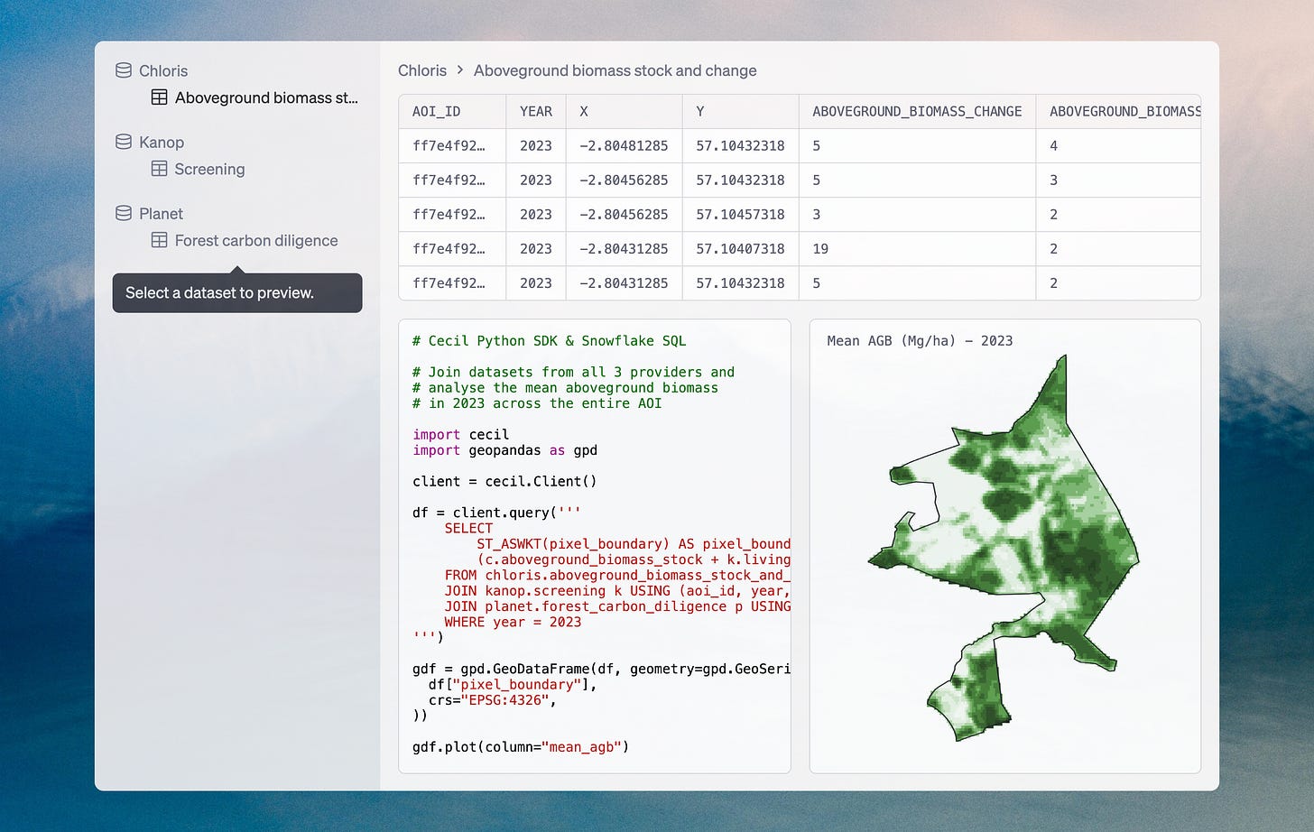
Cecil’s data platform makes nature data consistent, accessible, and ready for analysis. This includes the entire process of data acquisition from selected providers, data preparation using a preferred CRS and spatial resolution, and secure data access to connect nature data directly to analysis workflows. With Cecil, teams can easily monitor and track changes to nature at scale.
Curated datasets
Cecil identifies the core scientific concepts that represent nature, determines the most effective variables and technologies for measuring them, and curates multiple datasets to baseline and track change in these variables at the site level. We currently support a range of plant biomass datasets. Land use and land cover, as well as deforestation, are next on our roadmap.
Search the curated list of datasets by spatial and temporal attributes and assess datasets with Cecil’s documentation.
Analysis ready
Access nature data in a consistent format across all data providers. Cecil’s API allows users to acquire nature datasets from multiple providers and make all datasets joinable by configuring them to their preferred CRS and spatial resolution.
Cecil manages and processes files from chosen providers, delivering data into a database optimised for time-series and spatial analysis at scale. The platform allows users to securely connect programming languages and tools, such as Python, R, GIS, and BI tools, to deliver nature data directly into analysis workflows.
One stop for access
Build using Cecil with one contract, one integration, and no minimum usage requirements. Cecil partners with leading data providers to streamline contracting, compliance, integrations, and technical support.
Start accessing nature data today. Read the documentation to learn more about our API, the datasets we currently support, and the science behind our approach.
Notices
London's nature data community are gathering to geek out over dumplings and drinks this Wednesday 18th September. RSVP here.
Cecil + The Landbanking Group are hosting a breakfast during New York Climate Week on Thursday 26th September. RSVP here.
Cecil + Earthmover are bringing New York’s nature data community together to geek out over dumplings and drinks on Thursday 26th September. RSVP here.
Chloris Geospatial is hosting a breakfast during New York Climate Week to share how new VCM standards, project developers and buyers of carbon credits are using new monitoring technologies. RSVP here.
Kanop is running a pickleball, bagels and networking event at New York Climate Week. RSVP here.
Thank yous
A special thank you to everyone who supported us this month with feedback, introductions, and advice.
Adam Weiner, Alex Burns, Coby Strell, Danielle Rappaport, Elaine Mitchell, Gregg Treinish, Helen Crowley, Mac Bryla, Matthias Mohr, Nate Trappe, Noah Golmant, Peter Levine, Roberto Miethe, Romain Fau, Syakira Syafiqah, Sylvain Vaquer, and Wade Cooper.
Keep reading
Sponsorship
Do you want to share monthly updates with our engaged audience of 1700+ nature data users and investors? Please contact rory@cecil.earth to find out more about our newsletter sponsorship packages.
This newsletter is curated by Cecil, a team on a mission to make nature data accessible. Their platform helps data teams access analysis-ready commercial and public nature datasets, eliminating the need for cleaning, harmonising, and pre-processing tasks. Whilst currently focused on aboveground biomass, they will soon launch land cover and land use datasets to support market-leading nature-tech applications, consultants, and nature restoration professionals.
Enjoy the newsletter? Please forward to a friend.


